Ileana was a tropical storm in the North Pacific Ocean Thursday evening Pacific time, the National Hurricane Center said in its latest advisory.
The tropical storm had sustained wind speeds of 45 miles per hour.
All times on the map are Pacific time. By The New York Times
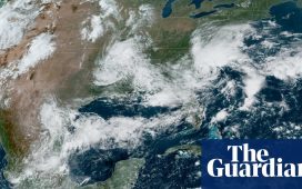
What does the storm look like from above?
Satellite imagery can help determine the strength, size and cohesion of a storm. The stronger a storm becomes, the more likely an eye will form in the center. When the eye looks symmetrical, that often means the storm is not encountering anything to weaken it.
Ileana is the ninth named storm to form in the Eastern Pacific in 2024.
Storms that form in the Atlantic or the Pacific generally move west, meaning Atlantic storms pose a greater threat to North America. If a storm forms in the Pacific close to land, it can bring damaging winds and rain before pushing out to sea.
However, an air mass can sometimes block a storm, driving it north or northeast toward the Baja California peninsula and the west coast of Mexico. Occasionally, a storm can move farther north, as Hurricane Hilary did last year, bringing damaging winds and intense rain to Southern California.
Hurricane season in the Eastern Pacific began on May 15, two weeks before the Atlantic season started. Both seasons run through Nov. 30.
Another factor for storm-watchers this year is the likely development of La Niña, the intermittent, large-scale atmospheric pattern that can affect weather worldwide.
In the Pacific Ocean, La Niña increases wind shear, which is a change in wind speed and/or direction with height. Those changes make it more difficult for storms to form. (In the Atlantic, La Niña has the opposite effect, reducing wind shear and increasing the chances for storm formation.)
Sources and notes
Tracking map Tracking data is from the National Hurricane Center. The map shows probabilities of at least 5 percent. The forecast is for up to five days, with that time span starting up to three hours before the reported time that the storm reaches its latest location. Wind speed probability data is not available north of 60.25 degrees north latitude.
Wind arrivals table Arrival times are generated from a New York Times analysis of National Hurricane Center data. Geographic locations use data from the U.S. Census Bureau and Natural Earth. Time zones are based on Google. The table shows predicted arrival times of sustained, damaging winds of 58 m.p.h. or more for select cities with a chance of such winds reaching them. If damaging winds reach a location, there is no more than a 10 percent chance that they will arrive before the “earliest reasonable” time and a 50 percent chance they will arrive before the “most likely” time.
Radar map Radar imagery is from the National Oceanic and Atmospheric Administration via Iowa State University. These mosaics are generated by combining individual radar stations that comprise the NEXRAD network.
Storm surge map Storm surge data is from the National Hurricane Center. Forecasts only include the United States Gulf and Atlantic coasts, Puerto Rico, and the U.S. Virgin Islands. The actual areas that could become flooded may differ from the areas shown on this map. This map accounts for tides, but not waves and not flooding caused by rainfall. The map also includes intertidal areas, which routinely flood during typical high tides.
Satellite map Imagery is from the National Oceanic and Atmospheric Administration and Japanese Meteorological Agency via the Cooperative Institute for Research in the Atmosphere.
Precipitation map Data for multi-day forecasts or observed rainfall totals are from the National Weather Service. The 1-day forecast is from the National Oceanic and Atmospheric Administration.
